e99 Online Shopping Mall

Geometry.Net - the online learning center Help  
Home  - Basic I - Indiana Maps (Books)

  1-20 of 101 | Next 20
A  B  C  D  E  F  G  H  I  J  K  L  M  N  O  P  Q  R  S  T  U  V  W  X  Y  Z  

click price to see details     click image to enlarge     click link to go to the store

$6.17
1. Indiana Atlas & Gazetteer
$12.71
2. Hiking Indiana (America's Best
$4.92
3. Rand Mcnally Indianapolis, Indiana
$4.79
4. Rand McNally Fort Wayne, Indiana
$4.95
5. American Map Fort Wayne, in Pocket
$8.95
6. South Bend & Elkhart, Indiana
$26.95
7. Family Maps of Vigo County, Indiana,
8. Rand McNally Indiana State: Map
 
9. Map of Indiana.
$16.00
10. Indiana: in relation to its geography,
 
11. A KEY TO ASHER AND ADAMS' NEW
 
12. Indiana Road Atlas (Universal
$26.95
13. Family Maps of Jay County, Indiana,
 
$153.50
14. Indiana Sportsman's Atlas
$34.20
15. Family Maps of Hendricks County,
$34.20
16. Family Maps of Marion County,
 
$111.89
17. Trails Illustrated: National Forests
$8.95
18. American Map Indiana State Slicker
$2.72
19. Indianapolis (Rand McNally Folded
$10.16
20. Hoosier National Forest Trails

1. Indiana Atlas & Gazetteer
by Delorme Publishing Company
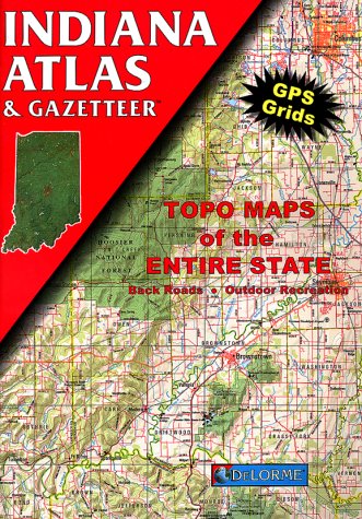
Paperback: 64 Pages (1998-03)
list price: US$16.95 -- used & new: US$6.17
(price subject to change: see help)
Asin: 0899332110
Average Customer Review: 5.0 out of 5 stars
Canada | United Kingdom | Germany | France | Japan
Editorial Review

Product Description
The first choice of outdoors enthusiasts. Beautiful, detailed, large-format maps of every state. Perfect for home and office reference, and a must for all your vehicles. Gazetteer information may include: campgrounds, attractions, historic sites & museums, recreation areas, trails, freshwater fishing site & boat launches, canoe trips or scenic drives. Categories vary by state ... Read more

Customer Reviews (8)

5-0 out of 5 stars Hoosier Highway Happiness
These are hands down, the best, most detailed, paper driving maps you will find. The details go all the way down to every litlle unpaved, unnamed, cowpath in a cornfield. Even the Indiana Department of Transportation Official Highway Map does not include all the roads that this does. When your digital world collides with analog reality, or you forget to bring it with you, these are the perfect backup. I wish Microsoft would use the Delorme mapping data used in these books for it's Streets & Trips product, instead of Navteq data.

4-0 out of 5 stars Indiana Atlas
This is a great atlas. It guides you through the back roads that are not well known.

5-0 out of 5 stars Bridge lover
As an avid covered bridge photographer, I have found these Atlases to be invaluable as a guide. The bridges (and other points of interest) are well marked and easy to find. My only complaint is that while traveling the book itself it too big and rather awkward to use without a navigator. A smaller book would be better. I will continue to buy them, however, as my search broadens.

5-0 out of 5 stars Indispensable Indiana Atlas
My wife and I use this atlas on a near-constant basis for work and fun.With pinpoint accuracy it helps us determine exactly which of Indiana's 92 counties an obscure country back road resides.This is invaluable to my title-searcher wife, saving her many hours and miles of wasted traveling to the wrong county seat.When out on the road exploring the wonderful small towns of our state it helps us navigate through unfamiliar territory and find alternate, interesting routes that we would not have otherwise discovered.Highly detailed, easy to read and follow, I happily recommend this publication to anyone requiring a really good and useful local state atlas.

5-0 out of 5 stars Indiana's best Atlas
This atlas is shows all the small roads and some long driveways, has GPS longitudes and latitudes, marks places of interest for day trips, and is useful for traveling the back roads to see the real Indiana. My wife and I are retired and are not usually in any hurry to get somewhere. This means we can drive the back roads to most places we desire to end up. With this map we actually get where we intend to go and still see some very interesting parts of Indiana. These maps are in constant use by us whether referencing locations mentioned in the news or in the van going somewhere. A great purchase with many uses.
... Read more


2. Hiking Indiana (America's Best Day Hiking Series)
by Sally McKinney
Paperback: 200 Pages (1999-10-28)
list price: US$19.95 -- used & new: US$12.71
(price subject to change: see help)
Asin: 0880119012
Average Customer Review: 4.0 out of 5 stars
Canada | United Kingdom | Germany | France | Japan
Editorial Review

Product Description
This is your complete guide to 100 of the best day hiking trails in Indiana. No matter what part of the state you want to explore or how easy or hard a trek you want, this handy book will lead you to the right trail.

Full of interesting and scenic destinations in the northern, central, and southern sections of the state, Hiking Indiana offers you a guided tour of 46 featured areas. The book even provides urban hiking areas in case you want to enjoy Indiana’s unique cities.

Hiking Indiana includes the following special features:

• Detailed descriptions of 100 trails, including the trail length, estimated time to hike it, and a difficulty rating

• 135 easy-to-read park and trail maps

• A map of each featured trail, with points of interest and trail distances

• Practical information on how to get to parks, the park hours, available facilities, permits and rules, and a contact address and phone number

• A convenient trail-finder grid, which provides a summary of each trail’s features and location in the book • A section on nearby points of interest, with contact phone numbers

Hiking Indiana brings to life the history, terrain, flora, and fauna of each area. And its descriptions of nearby recreational and sightseeing destinations ensure that you won't miss anything on your trip.

Hiking Indiana is part of America’s Best Day Hiking Series from Human Kinetics. ... Read more

Customer Reviews (4)

3-0 out of 5 stars Book needs an update
There have been so many changes since this book was published in 2000: trails extended - gps capabilities (which did exist then however coordinates aren't cited) - trails closed.This book is a starting point for hiking in Indiana.Yes - it's great that it indicates where things are - but guidance once you get there is a little lacking.

Needs an update for GPS - and a revisit to all the locations - frankly she she make this into an ebook.

5-0 out of 5 stars Living Large
I have lived in Indiana for 16 yrs and have walked,hiked and horseback rode all the popular spots. This book has already found me a ton of new exciting places to go!

2-0 out of 5 stars State park rehash
I was disappointed. A large part of this book draws on the Indiana state park system.Granted, the parks have some wonderful trails, but trail maps are distributed when you enter the parks. This book gives you little of theadventurous or out-of-the-way.

5-0 out of 5 stars Wander Indiana with this great day hiking guide
Hiking Indiana is an organized guide to finding your way around on foot.When I opened Hiking Indiana, the first surprise was its "workbook" format - the pages are perforated on the edge to betorn out and packed.It's really a book to be used and become as worn outas a hiker after a good day on the trails.The first pages include a TrailFinder chart and a state map with numbers matching the table of contentsthat is organized by North, Central and South regions of the state.Thereare 45 parks or cities as chapters that include several Trail Sites andTrails.Park Facilities are shown by key icons, miles listed and TrailDifficulty Rating that is shown by 1 boot for easiest and 5 for mostdifficult trails.The chart also shows Terrain/Landscape with checkmarksfor hills, prairie/grass, forest, lake, wetlands, overlook andriver/stream.I was also surprised to see historic trails and city trailssuch as Madison's Historic District Walking Tour, Columbus' ArchitectureWalk, and Indianapolis' Canal Walk and Eagle Creek Bird Sanctuary Loop. There's even a canoe trail for those, as they said, with extra hour to givefeet a rest.There are maps of parks and trails, but you'll need youratlas or state road map to get to the site.The narrative is an easy readand informative. Sally McKinney includes cautions, such as the trail goesthrough remote, forested hill country and to let park officials know whenyou leave and expect to return, to check back in or park officials may golooking for you. Another caution is when you have to walk through shallowwater - a creek without a bridge, and which trails to watch for plenty ofdroppings from waterfowl.Hiking Indiana throws in tidbits on the state'shistory.Ouabache State Park has a Wildlife Exhibit Loop with bison, and'Did you know that a bison image decorates the Indiana state seal?' This isa book to leaf through and explore. I really liked Hiking Indiana since itis a good read, lets you explore places to go, and made it all interesting.I am ready and motivated to go from wannabe hiker to getting out the hikingboots. ... Read more


3. Rand Mcnally Indianapolis, Indiana Folded Map (Rand McNally Streets Of...)
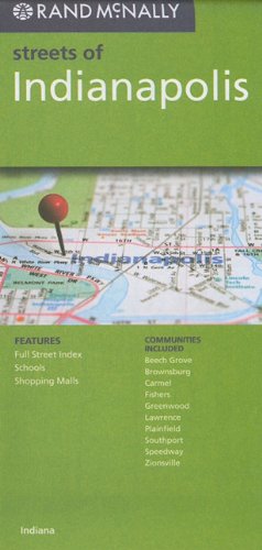
Map: Pages (2010-02)
list price: US$5.99 -- used & new: US$4.92
(price subject to change: see help)
Asin: 052887991X
Canada | United Kingdom | Germany | France | Japan

4. Rand McNally Fort Wayne, Indiana Folded Map (Rand McNally Streets Of...)
Map: Pages (2010-02)
list price: US$5.99 -- used & new: US$4.79
(price subject to change: see help)
Asin: 0528879855
Canada | United Kingdom | Germany | France | Japan

5. American Map Fort Wayne, in Pocket Map
Map: Pages (2008-08-20)
list price: US$4.95 -- used & new: US$4.95
(price subject to change: see help)
Asin: 0841610223
Canada | United Kingdom | Germany | France | Japan

6. South Bend & Elkhart, Indiana Slicker (City Slicker)
Map: Pages (2008-11-12)
list price: US$8.95 -- used & new: US$8.95
(price subject to change: see help)
Asin: 0841611319
Canada | United Kingdom | Germany | France | Japan

7. Family Maps of Vigo County, Indiana, Deluxe Edition
by Gregory A. Boyd
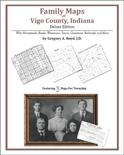
Paperback: 188 Pages (2010-07-16)
-- used & new: US$26.95
(price subject to change: see help)
Asin: 1420311956
Canada | United Kingdom | Germany | France | Japan
Editorial Review

Product Description
Locating original landowners in maps has never been an easy task--until now. This volume in the Family Maps series contains newly created maps of original landowners (patent maps) in what is now Vigo County, Indiana, gleaned from the indexes of the U.S. Bureau of Land Management. But it offers much more than that. For each township in the county, there are two additional maps accompanying the patent map: a road map and a map showing waterways, railroads, and both modern and many historical city-centers and cemeteries.

Included are indexes to help you locate what you are looking for, whether you know a person's name, a last name, a place-name, or a cemetery. The combination of maps and indexes are designed to aid researchers of American history or genealogy to explore frontier neighborhoods, examine family migrations, locate hard-to-find cemeteries and towns, as well as locate land based on legal descriptions found in old documents or deeds.

The patent-maps are essentially plat maps but instead of depicting owners for a particular year, these maps show original landowners, no matter when the transfer from the federal government was completed. Dates of patents typically begin near the time of statehood and run into the early 1900s.

This high-quality paperback book from the critically acclaimed Family Maps series measures 8-3/8" wide x 10-5/8" high. ... Read more


8. Rand McNally Indiana State: Map (State Maps-USA)
by Rand McNally
Paperback: 1 Pages (1999-05)
list price: US$3.95
Isbn: 052897419X
Canada | United Kingdom | Germany | France | Japan

9. Map of Indiana.
by (INDIANA)
 Unknown Binding: Pages (1897)

Asin: B00455VUPU
Canada | United Kingdom | Germany | France | Japan

10. Indiana: in relation to its geography, statistics, institutions, county topography, etc., with a "reference index" to Colton's maps of Indiana. Compiled from official and other authentic sources
by Richard Swainson Fisher, J H. 1800-1893 Colton
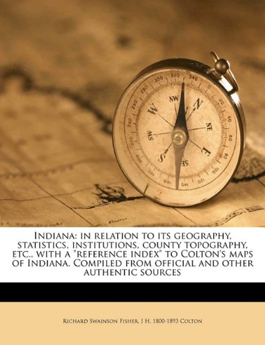
Paperback: 152 Pages (2010-08-02)
list price: US$21.75 -- used & new: US$16.00
(price subject to change: see help)
Asin: 1176724029
Canada | United Kingdom | Germany | France | Japan
Editorial Review

Product Description
This is an EXACT reproduction of a book published before 1923. This IS NOT an OCR'd book with strange characters, introduced typographical errors, and jumbled words.This book may have occasional imperfections such as missing or blurred pages, poor pictures, errant marks, etc. that were either part of the original artifact, or were introduced by the scanning process. We believe this work is culturally important, and despite the imperfections, have elected to bring it back into print as part of our continuing commitment to the preservation of printed works worldwide. We appreciate your understanding of the imperfections in the preservation process, and hope you enjoy this valuable book. ... Read more


11. A KEY TO ASHER AND ADAMS' NEW CIVIL AND CONGRESSIONAL TOWNSHIP MAP OF INDIANA.
by E.J. Rice
 Hardcover: Pages (1885)

Asin: B003ZSVXVO
Canada | United Kingdom | Germany | France | Japan

12. Indiana Road Atlas (Universal Maps)
by Universal Map
 Paperback: 71 Pages (2000-11)
list price: US$9.95
Isbn: 076251549X
Canada | United Kingdom | Germany | France | Japan

13. Family Maps of Jay County, Indiana, Deluxe Edition
by Gregory A. Boyd
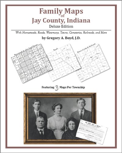
Paperback: 172 Pages (2010-07-16)
-- used & new: US$26.95
(price subject to change: see help)
Asin: 142031369X
Canada | United Kingdom | Germany | France | Japan
Editorial Review

Product Description
Locating original landowners in maps has never been an easy task--until now. This volume in the Family Maps series contains newly created maps of original landowners (patent maps) in what is now Jay County, Indiana, gleaned from the indexes of the U.S. Bureau of Land Management. But it offers much more than that. For each township in the county, there are two additional maps accompanying the patent map: a road map and a map showing waterways, railroads, and both modern and many historical city-centers and cemeteries.

Included are indexes to help you locate what you are looking for, whether you know a person's name, a last name, a place-name, or a cemetery. The combination of maps and indexes are designed to aid researchers of American history or genealogy to explore frontier neighborhoods, examine family migrations, locate hard-to-find cemeteries and towns, as well as locate land based on legal descriptions found in old documents or deeds.

The patent-maps are essentially plat maps but instead of depicting owners for a particular year, these maps show original landowners, no matter when the transfer from the federal government was completed. Dates of patents typically begin near the time of statehood and run into the early 1900s.

This high-quality paperback book from the critically acclaimed Family Maps series measures 8-3/8" wide x 10-5/8" high. ... Read more


14. Indiana Sportsman's Atlas
by Universal Map
 Spiral-bound: 106 Pages (1997-10)
list price: US$15.95 -- used & new: US$153.50
(price subject to change: see help)
Asin: 0762516089
Canada | United Kingdom | Germany | France | Japan
Editorial Review

Product Description
The ultimate sporting and recreational guide. The atlas includes roads, hotels, motels and attractions plus: wildlife areas; forestry and Forest Service areas; natural and preserve areas; national, state and local park and recreation areas; conservancy districts; public use and public hunting areas; fishing access in streams, rivers, ponds and lakes; types of boats allowed and horsepower limits; boat and canoe access and rental information; shooting and archery ranges; campsite and facility information; golf courses and driving ranges; back packing and hiking trails; bridle trails and equestrian facilities; winter sports facilities such as skiing, sledding, ice skating and snowmobile trails. ... Read more


15. Family Maps of Hendricks County, Indiana, Deluxe Edition
by Gregory A. Boyd
Spiral-bound: Pages (2006)
-- used & new: US$34.20
(price subject to change: see help)
Asin: 1420302248
Canada | United Kingdom | Germany | France | Japan

16. Family Maps of Marion County, Indiana, Deluxe Edition
by Gregory A. Boyd
Spiral-bound: Pages (2006)
-- used & new: US$34.20
(price subject to change: see help)
Asin: 142030383X
Canada | United Kingdom | Germany | France | Japan

17. Trails Illustrated: National Forests Topo Map - Hoosier National Forest - Indiana, USA (National Forest/BLM)
by Trails Illustrated
 Map: 1 Pages (1997-01)
list price: US$9.95 -- used & new: US$111.89
(price subject to change: see help)
Asin: 1566950511
Average Customer Review: 4.0 out of 5 stars
Canada | United Kingdom | Germany | France | Japan
Editorial Review

Product Description
This Trails Illustrated topographic map for Dinosaur National Monument, which straddles the state lines of northwest Colorado and northeast Utah, is the perfect recreational map for this stunning monument. Within its craggy hills, you can discover pieces of a long ago world where the largest land creatures of all time once roamed and died.

The map includes the entire national monument area, with detailed trails and topographic information. Included are the Lodore Nature Trail, The Green River, Yampa River, Jenny Lind Rock, Harpers Corner Nature Trail, Rainbow Park, Dinosaur Quarry, the Green Riuver Campground, and much more. The map is full of detailed trail information, park information, history and culture, geology, and natural history.

Approximately 4 1/4" x 9 1/4" folded; 27" x 39" fully opened
Scale = 1:78,125 ... Read more

Customer Reviews (4)

3-0 out of 5 stars Recreational Map
I was disappointed in this map.It's not much better than
any road map, and doesn't provide any useful information
about points of interest.

5-0 out of 5 stars great map
These are great reference maps for generalized recreational activities.Not as detailed as a topo map, but still packed full of outstanding information.I have one for every state and I don't leave home with out them.An improvement over simple highway maps.

4-0 out of 5 stars Beautiful map, but scale too small
The map is beautiful and (reasonably) accurate, but its small scale limits its use for hiking. Many of the contours are so closely spaced, faint, or interrupted by text that they are nearly useless. The publishers tried to squeeze the entire national monument onto one map sheet, which makes for a good overview and planning map, but a poor hiking map.
Unfortunately, you have rather limited options, at least when it comes to paper maps: The USGS 7.5 minute topo sheets are great, but they don't show the trails, local hiking maps are hit and miss (some can be great). State-wide mapping software that lets you print customized hiking maps might be the way to go, but I haven't tried them yet.

5-0 out of 5 stars Essential map for hiking Isle Royale
This map is part of the Trails Illustrated series covering many national parks.These are all sturdy and convenient.

Your map choices are essentially this one, the National Park Service map, and USGS topos.The NPS map is fine if you're staying at Rock Harbor Lodge and doing light day activities from that base.

If you're backpacking, or doing long day hikes, the Trails Illustrated map is absolutely essential because the USGS topographic maps are outdated.For example, the topo shows a no-longer-existent East Feldtmann trail on the southwest part of the island.

The topo also shows inaccurately the trail that goes over White Oak Ridge in the same area.The Trails Illustrated map shows the trails correctly.

This map also shows (1) group and individual campsites and (2) distances between trail junctions that accord with the NPS signage.Both features make it useful for planning your trip.
... Read more


18. American Map Indiana State Slicker
Map: Pages (2007-10-17)
list price: US$8.95 -- used & new: US$8.95
(price subject to change: see help)
Asin: 0841600252
Canada | United Kingdom | Germany | France | Japan

19. Indianapolis (Rand McNally Folded Map: Cities)
by Rand McNally, Navigation Technologies Corporation
Map: Pages (2003-10)
list price: US$4.95 -- used & new: US$2.72
(price subject to change: see help)
Asin: 0528994042
Canada | United Kingdom | Germany | France | Japan
Editorial Review

Product Description
This detailed map of Indianapolis, Indiana has complete coverage for the city and surrounding area. Map includes an inset map for downtown, plus most major tourist and business districts. When you flip the map over, you will find a complete street index and a "city and vicinity" map of the entire metro area. ... Read more


20. Hoosier National Forest Trails Illustrated Map # 770 (National Geographic Maps: Trails Illustrated)
by National Geographic Maps
Map: Pages (2008-01-01)
list price: US$11.95 -- used & new: US$10.16
(price subject to change: see help)
Asin: 1566954215
Canada | United Kingdom | Germany | France | Japan
Editorial Review

Product Description
Coverage includes Patoka Lake State Reservoir, Harrison Crawford State Forest, Ohio River, Yellowbank State Wildlife Management Area, Brown County State Park, Martin State Forest, insets of Two Lakes and German Ridge. Towns include Tell City, Bloomington, Mitchell, Paoli, Orleans, French Lick. Includes UTM grids for use with your GPS unit.

Approximately 4 1/4" x 9 1/4" folded; 27" x 39" fully opened
Scale = 1:70,000 & 1:35,000
Map revised - 2008 ... Read more


  1-20 of 101 | Next 20
A  B  C  D  E  F  G  H  I  J  K  L  M  N  O  P  Q  R  S  T  U  V  W  X  Y  Z  

Prices listed on this site are subject to change without notice.
Questions on ordering or shipping? click here for help.

site stats