e99 Online Shopping Mall

Geometry.Net - the online learning center Help  
Home  - Basic M - Michigan Maps (Books)

  1-20 of 100 | Next 20
A  B  C  D  E  F  G  H  I  J  K  L  M  N  O  P  Q  R  S  T  U  V  W  X  Y  Z  

click price to see details     click image to enlarge     click link to go to the store

$11.22
1. Michigan Atlas & Gazetteer
$4.95
2. Rand McNally Macomb County Michigan
$35.95
3. Family Maps of Oakland County,
$10.46
4. 50 Hikes in Michigan: The Best
$46.98
5. Mapping in Michigan & the
 
$228.24
6. Bibliography of the printed maps
$2.00
7. Rand McNally Easy to Read! Michigan
$5.95
8. University of Michigan & Ann
9. Michigan County Atlas (State Atlas
 
$29.95
10. Trail Atlas of Michigan: Mountain
$12.05
11. Backpacking in Michigan
$44.84
12. The Atlas of Breeding Birds of
 
$5.95
13. Northwest Michigan - Regional
$4.95
14. Folded Map Oakland County South
 
$63.96
15. The Complete City Maps of Michigan
 
16. ROAD MAP OF KENT COUNTY MICHIGAN
$32.95
17. Family Maps of Calhoun County,
$77.43
18. Rand McNally Ann Arbor Brighton/Howell
$35.95
19. Michigan bibliography. A partial
 
20. Michigan Northern Highlands (State

1. Michigan Atlas & Gazetteer
by Delorme Mapping Company
Paperback: 120 Pages (2000-12)
list price: US$19.95 -- used & new: US$11.22
(price subject to change: see help)
Asin: 0899333354
Average Customer Review: 4.5 out of 5 stars
Canada | United Kingdom | Germany | France | Japan
Editorial Review

Product Description
The first choice of outdoors enthusiasts. Beautiful, detailed, large-format maps of every state. Perfect for home and office reference, and a must for all your vehicles. Gazetteer information may include: campgrounds, attractions, historic sites & museums, recreation areas, trails, freshwater fishing site & boat launches, canoe trips or scenic drives. Categories vary by state ... Read more

Customer Reviews (20)

3-0 out of 5 stars Useful but with Limitations
A useful tool for getting off the main roads but limited in that it does not distinguish between almost impassable dirt backroads and passable paved and or dirt roads. Better than nothing but should not be used as a stand-alone atlas. Have additional county and/or topo maps as references for serious backroad exploration.

5-0 out of 5 stars Michigan Atlas & Gazetteer
If you are a hiker, biker, camper or boater, a gazetteer is a MUST.And Amazon's stellar service made it easy to update our very old copy.

5-0 out of 5 stars DeLorme Atlas
As expected the delorme arlases always deliver. Accurate travel information with details any outdoorsman needs to find the hidden out-of-the-way spots.

2-0 out of 5 stars New style is hard to read and use
The Michigan Atlas & Gazetteer that I just received is a new redesigned style, and it is too busy to read, and minor roads-- the very reason that I bought this-- are not labeled clearly. Up to this point, I have always been happy with the gazetteers, we have several, and rely on them when on vacation to go places that are not on other maps. I will try to locate a used one that is in the "old" format, and that I have been very happy with.

4-0 out of 5 stars Just as advertised
Comes in handy for all the major and back roads, but could use a little more detail for small city roads. ... Read more


2. Rand McNally Macomb County Michigan Local Map (Rand McNally City Maps)
by Rand McNally and Company
Map: 1 Pages (2003-01)
list price: US$4.95 -- used & new: US$4.95
(price subject to change: see help)
Asin: 0528993380
Canada | United Kingdom | Germany | France | Japan
Editorial Review

Product Description
This detailed map of Macomb County, Michigan has complete coverage for the county, plus most major tourist and business districts. When you flip the map over, you will find a complete street index and a "city and vicinity" map of the entire metro area. ... Read more


3. Family Maps of Oakland County, Michigan, Deluxe Edition
by Gregory A. Boyd
Paperback: 394 Pages (2010-07-16)
-- used & new: US$35.95
(price subject to change: see help)
Asin: 1420313525
Canada | United Kingdom | Germany | France | Japan
Editorial Review

Product Description
Locating original landowners in maps has never been an easy task--until now. This volume in the Family Maps series contains newly created maps of original landowners (patent maps) in what is now Oakland County, Michigan, gleaned from the indexes of the U.S. Bureau of Land Management. But it offers much more than that. For each township in the county, there are two additional maps accompanying the patent map: a road map and a map showing waterways, railroads, and both modern and many historical city-centers and cemeteries.

Included are indexes to help you locate what you are looking for, whether you know a person's name, a last name, a place-name, or a cemetery. The combination of maps and indexes are designed to aid researchers of American history or genealogy to explore frontier neighborhoods, examine family migrations, locate hard-to-find cemeteries and towns, as well as locate land based on legal descriptions found in old documents or deeds.

The patent-maps are essentially plat maps but instead of depicting owners for a particular year, these maps show original landowners, no matter when the transfer from the federal government was completed. Dates of patents typically begin near the time of statehood and run into the early 1900s.

This high-quality paperback book from the critically acclaimed Family Maps series measures 8-3/8" wide x 10-5/8" high. ... Read more


4. 50 Hikes in Michigan: The Best Walks, Hikes, and Backpacks in the Lower Peninsula
by Jim Dufresne
Paperback: 308 Pages (1999-09)
list price: US$17.95 -- used & new: US$10.46
(price subject to change: see help)
Asin: 0881504556
Average Customer Review: 4.5 out of 5 stars
Canada | United Kingdom | Germany | France | Japan
Editorial Review

Product Description
Lifelong Michigan resident Jim DuFresne, the author of numerous books on Michigan and the outdoors, guides bikers through Michigan's unequaled system of state parks and natural and wilderness areas, where the scenery and trails are as varied as anywhere in the country. As DuFresne notes in his introduction, "From sand dunes without even a blade of grass, to the towering monarchs of Hartwick Pines' virgin forests, from miles of beach that turn gold with every Lake Michigan sunset to one of the eleven thousand inland lakes where on a still evening bass rise to the surface like trout--all these wonders of the Midwest can be reached by hiking foot trails." The hikes in this completely revised and expanded second edition range from 1.5 to 35 miles in length. Hikers will learn where to find the best trailside fishing, birding, and wildlife watching, as well as where to go to find fall color and undisturbed backcountry camping. Each hike description includes directions to the trailhead; a detailed map; trail distance, difficulty, and hiking time; explicit trail directions, and a description of natural and historic features along the way. ... Read more

Customer Reviews (4)

4-0 out of 5 stars Great book
It is a little outdated as the trails have changed slightly but still good for knowing where they all are. It has very detailed descriptions of the trails and what is at each location. I wish it had more maps but it will do just fine.

5-0 out of 5 stars A good guide
This is a very good guide to some of the most scenic hikes in Michigan.If you want to find some good advice about finding beatiful places to hike, but don't need a huge atlas that lists every trail, this book is for you. It is a managable size and has good directions, and the trails are really well-selected.You won't be disappointed by any of them.The book is quite inexpensive.If you want a huge book that gives you every trail in Michigan, choose "Michigan Trail Atlas" by Hansen instead, but it is very big and kind of costly.

4-0 out of 5 stars MICHIGAN'S GREAT TREASURES
I recently had a friend of my wife comment on how I knew all the good and "secret" places to go in Michigan. This is not true, but I do often wonder at how people know of some of the truly great places to go in my home state.

Any knowledge that I might have comes from owning several books written by Jim Dufresne. Dufresne is among a handful of what I consider the best writers out there when it comes to the outdoors/travel. Happily, he lives in and writes about my home state.

I not only own this 50 hikes book, but I have books written by Dufresne on hiking with children in Michigan, Michigan's State Parks, the Porcupine Mountains, and the best campgrounds in Michigan. With the exception of the Porcupine Mountains book (which is of a narrower interest) all of these books are indispensable.

50 hikes in Michigan (there are actually 60 hikes listed) really does contain most of the best hikes in the lower peninsula of Michigan. From this book I learned of the Algonquin trail in beautiful and semi-remote Negwegon State Park (you won't find any brown signs on the main roads leading you there). This hike alone is worth the price of the book.

But why stop there?

You can also explore such places as the Sleeping Bear Dunes National Lakeshore, the Manistee River Trail and the plethora of shorter trails in Waterloo State Recreation area. These hikes and the others listed in this well-written and engaging book are some of the best to be found anywhere. I only wish there were an Upper Peninsula edition.

Jim Dufresne himself, though not homegrown, is one of Michigan's great treasures. I recommend this book and others by him.

Get a copy today.

5-0 out of 5 stars New to Michigan or new to hiking, this is a must read!
If you are new to Michigan or new to hiking, hiking guru Jim Dufresne's "50 Hikes in Michigan" is required reading.

From the Sleeping Bear Dunes National Lakeshore to the Ohio state line, "50 hikes" lists the wildest but easiest to find, easiest to hike trails.

"Wild" usually discourages the novice, however, rest assured these are all well traversed trails and usually well marked.

This is my second copy, and I bring it with me in the field.Having hiked nearly all of the trails in his book (including all of the North Country Trail segments, and all the others not in the book), I have learned to take this book with me on my hike.

A tip:keep it in a zip lock bag.Those of you who are familiar with Michigan's weather know--it may be sunny, but wait a few minutes, it could rain! ... Read more


5. Mapping in Michigan & the Great Lakes Region
Hardcover: 377 Pages (2007-10)
list price: US$69.95 -- used & new: US$46.98
(price subject to change: see help)
Asin: 0870138073
Average Customer Review: 5.0 out of 5 stars
Canada | United Kingdom | Germany | France | Japan

Customer Reviews (2)

5-0 out of 5 stars Spectacular
This is beautiful book.It is well researched and the information is presented thoughtfully.The quality of the printing, binding and map reproduction is excellent.This is a fascinating read for anyone interested in the Great Lakes Region and it's history.I highly recommend it.

5-0 out of 5 stars A seminal work of meticulous and articulate scholarship

Expertly compiled and deftly edited by David I. Macleod (Professor of History, Central Michigan University), "Mapping In Michigan & The Great Lakes Region" is a compilation of twelve studies that, taken together, illustrated the many different configurations taken by geographical, urban, and property maps of and around the Great Lakes and the state of Michigan, including changes within a single region. The sixteen learned and expert contributors reveal the history of the area's cartography and deal with such specifics as the peninsulas and freshwater seas, the history mapping this region, how the Europeans appropriated and settled these lands, social and political negotiations and conflicts, and more. Profusely illustrated throughout with reproductions of historic maps from the beginnings of regional exploration down to the present day, ""Mapping In Michigan & The Great Lakes Region" is a seminal work of meticulous and articulate scholarship which is very strongly recommended for academic library American History reference collections, as well as a personal library acquisition selection for cartography enthusiasts. ... Read more


6. Bibliography of the printed maps of Michigan, 1804-1880,: With a series of over one hundred reproductions of maps constituting an historical atlas of the Great lakes and Michigan,
by Louis Charles Karpinski
 Unknown Binding: 539 Pages (1931)
-- used & new: US$228.24
(price subject to change: see help)
Asin: B0006ALI96
Canada | United Kingdom | Germany | France | Japan

7. Rand McNally Easy to Read! Michigan State Map
Map: Pages (2009-07-27)
list price: US$4.95 -- used & new: US$2.00
(price subject to change: see help)
Asin: 0528878492
Average Customer Review: 4.0 out of 5 stars
Canada | United Kingdom | Germany | France | Japan

Customer Reviews (1)

4-0 out of 5 stars michigan map
I like maps and this is a good one.Was up-to-date and proved to be very useful on our trip to Michigan. ... Read more


8. University of Michigan & Ann Arbor Streets (Professor Pathfinder's Campus Maps)
by Hedberg Maps
Map: 1 Pages (2007-01-05)
list price: US$5.95 -- used & new: US$5.95
(price subject to change: see help)
Asin: 1593530285
Average Customer Review: 5.0 out of 5 stars
Canada | United Kingdom | Germany | France | Japan
Editorial Review

Product Description
An amazingly detailed map of downtown and the campus, with insets of key shopping areas, is backed up with a large-scale, readable, throughly field-checked street map, and an Ann Arbor-Ypsilanti regional map. Completely indexed. ... Read more

Customer Reviews (3)

5-0 out of 5 stars Ann Arbor Map
I gave this as a high school graduation present to someone who is going to U. of Michigan in the fall. Great idea.

5-0 out of 5 stars very useful
this is an impressive map that has different zooms of the Ann Arbor area. I took it with me when apartment hunting and it was very helpful. in the interest of full disclosure, there are free downtown maps available here and there (i saw some in the Maynerd parking entrance), but people who saw my map said it was much better.

5-0 out of 5 stars Perfect way to get to know Ann Arbor
I don't often rave about maps (in fact, I never rave about maps), but this is one I've grown to love. It's a perfect size and scale and was incredibly easy to read, even as I drove along new streets in my new city. Particularly useful was that large grocery and retail stores are marked on the map. This made it easy to figure out the closest Target, Best Buy, or grocery store from my new apartment, and the stores ended up serving as landmarks as well as new places to shop. Also, when you're on the phone, trying to locate a smaller store, they can say, "We're located across the street from the Whole Foods Market," or "We're at the north end of the such-and-such mall," and you know just how to find them. The map even shows you what block you're on -- helpful when searching for a specific address. I'm one of those people who gets lost going around the block, but this map got me where I had to go every time.

Also included is a very detailed and clear map of campus.

I bought two maps of Ann Arbor but never used the second one. This map did it all.Highly recommended. ... Read more


9. Michigan County Atlas (State Atlas Series)
by Universal Map
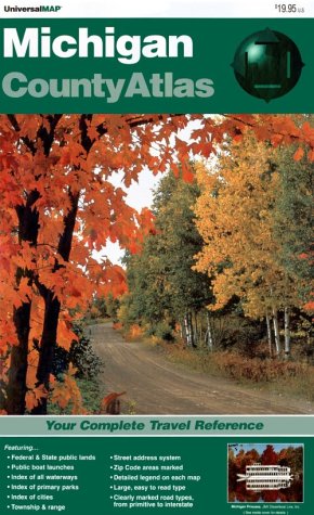
Paperback: 184 Pages (1992-12)
list price: US$19.95
Isbn: 0762501081
Average Customer Review: 3.0 out of 5 stars
Canada | United Kingdom | Germany | France | Japan
Editorial Review

Product Description
Your complete Michigan travel reference! This large-size road atlas features full-color, county-by-county maps for all of Michigan. Each county is mapped separately, along with county indexes for roads, water features and place name. Also included are county facts and narrative description with a primary parks table that lists park features and facilities. Whether your travel is business or pleasure in Michigan, this atlas has it all, including: county / state / U.S. / Interstate roads, cities and towns, federal and state lands, water features, parks, Zip Code boundaries and numbers, airports, hospitals, street address system, Township/Range/Section, ski areas, state boundaries, county boundaries, township boundaries, incorporated area boundaries, military areas, state police locations, golf courses, public boat launches, and much more. The Michigan County Atlas is printed in full color, 11-inches by 17.5-inches in size, perfect bound paperpack, on high quality paper. ... Read more

Customer Reviews (8)

1-0 out of 5 stars Missing counties
I purchased and then returned this map.I wanted a Michigan county map as we were going camping in the Upper Peninsula.Imagine my surprise when I received the map and found it did not have all the counties in Michigan, especially in the U.P. Very disappointing, doubt if I buy from this map maker again.

2-0 out of 5 stars Not Complete
This atlas does NOT contain all the counties in Michigan - It's lacking all of the southern counties in the U.P.

4-0 out of 5 stars Wonderful Photographer's Gear
This is used on all my photographic outings (and geo-caching), both as a traveling map and as a record keeping journal.A pen is used for notating where pictures were taken as well as places and to call attention to things and places that are possible future photo ops.Secondly, a yellow highlighter is used to record roads taken on each trip.Combining both makes for a powerful photographer's planner and journal.

The down-side is that it's very difficult to flip from page to page.The State is divided by counties (with fabulous detailed features) within West to East strips. Most roads don't run exactly horizontal, so you may need to cross over several levels of 'strips'.There are "continue on page..." notations on all four sides of each page, which does help some.

However, too many details on the outer edges of the pages are difficult to find and read (like my home is nearly invisible.)This situation would be improved by allowing a larger margin for the notations, so that they don't cover pertinent details.

The book is huge and includes more info than you would think you could need (like every water spot in the State and wildlife preserves, etc.)However, it's amazing how many places you can find that you didn't even know you were looking for.

Add a 'regular' map to this Atlas, and you're good to go for years of pleasurable traveling.

2-0 out of 5 stars Delorme Atlas is much better
I used the Universal Map book for a number of years.Then one day I saw the Delorme Atlas And Gazetteer.The Delorme Atlas is way better, much better use of color, much better topographic information, hiking trail info, and easier to navigate.

1-0 out of 5 stars Very Out-of-Date; Some Maps from 1984!
When the first edition of this map book came out in the 1980s, it was most definitely one of the best, most up-to-date county road map atlases of Michigan. However, almost no updates to the maps inside have been made in this book since the early-1990s, with many of the maps inside dating from 1984, some of the oldest being in the rapidly-changing Metro Detroit area! Entire freeways have been built and opened since the maps in this book were last updated.

There are other titles similar to this one that are marginally better, however, I would wholeheartedly recommend anyone needing county-based road maps similar to those included in this atlas to purchase the more up-to-date Regional County Map series from Universal Map. These folding maps--13 cover almost the entire state--are actually the "descendents" of the maps in this atlas. Compare any of the maps in the Michigan Regional County Map titles to those in this book and you get a clear picture of the problem. It is unclear why Universal map has continued to issue new editions of the folding maps year after year, yet has allowed those in this atlas to languish. New editions of other similar atlases (with revisions) are issued by other companies every few years, yet this atlas has remained substantially unaltered for almost twenty years.

While not as convenient, the higher quality and more up-to-date nature of the 13 individual folding maps are more than enough reason to steer clear of this atlas. You can find the regional map titles--Southwest Michigan, South-Central Michigan, Southeast Michigan, Michigan's Thumb, Mid-Michigan, Saginaw Valley of Michigan, Mid-West Michigan, Central Michigan, Northwest Michigan, Northern Highlands of Michigan, Northern Tip of Michigan, Eastern Upper Peninsula, and Copper Country of Michigan's U.P., in gas stations, many bookstores or online. These folding maps also contain insets of many of the cities, towns and villages in that region that are not included in the atlas. If you still need to have the convenience of a bound atlas, I would then recommend either the "Mapbook of Michigan Counties" published by the Michigan United Conservation Clubs or the "Michigan Atlas and Gazetteer" by DeLorme. ... Read more


10. Trail Atlas of Michigan: Mountain Biking, Hiking, Cross-Country Skiing, and Nature Trails.
by Dennis Hansen
 Paperback: 594 Pages (1997-01)
-- used & new: US$29.95
(price subject to change: see help)
Asin: 0930098056
Average Customer Review: 4.5 out of 5 stars
Canada | United Kingdom | Germany | France | Japan

Customer Reviews (5)

5-0 out of 5 stars Great resource
So far, every trail description and thedirections to get there have been right on.

5-0 out of 5 stars Best guide to trails in Michigan
All you need is this book to find the perfect trails for you anywhere in Michigan.I recommend this to anyone who bikes, hikes, skis or enjoys nature.What a great gift!

5-0 out of 5 stars I wish there was a book like this for every state!
This is an excellent book for anyone who lives in Michigan. We've used it for hiking and cross country skiing, and it provides excellent accurate information.

4-0 out of 5 stars One stop research
Hansen's book is a staple in any adventurer's library whether you ski, hike or bike.He's to the point. With so many trails to cover in both peninsulas it's tough to stay current.He should update it yearly.

4-0 out of 5 stars the best trails in michigan all in one book
This book has some of the best trails in Michigan and directions to all of them. It lets you know the level of difficulty for each one. I recommend this book for anyone interested in exploring the great outdoors. ... Read more


11. Backpacking in Michigan
by Jim DuFresne
Paperback: 352 Pages (2007-12-21)
list price: US$18.95 -- used & new: US$12.05
(price subject to change: see help)
Asin: 0472032682
Average Customer Review: 5.0 out of 5 stars
Canada | United Kingdom | Germany | France | Japan
Editorial Review

Product Description

With 65 photographs and 77 detailed maps, this indispensable guide to the state's hiking trails gives beginners to advanced hikers all the information they need to plan their next Michigan overnight or weekend backpacking trip. Featuring 50 trails---27 in the Lower Peninsula---ranging from one-hour to multiple-day treks in both the Upper and Lower Peninsulas, Backpacking in Michigan has something for every hiker.

Information on hike length and difficulty, elevation gain, the amount of time needed to complete the hike, camping facilities, and nearby towns accompanies each of the trail listings. The author also provides extensive reference maps along with a description of scenic highlights. In addition to backcountry explorations of remote trails, Backpacking in Michigan includes classic Michigan adventures such as the Lakeshore Trail in Pictured Rocks National Lakeshore, the Greenstone Ridge Trail in Isle Royale National Park, North Manitou Island in Sleeping Bear Dunes National Lakeshore, and Jordan River Pathway in the Mackinaw State Forest.

While Backpacking in Michigan focuses primarily on the trails themselves, it also makes planning your Michigan adventure as easy as possible by providing important information on routes to and from the trailhead, as well as park fees and reservation information for shelters, walk-in cabins, rental yurts, and overnight camping.

Jim DuFresne is a Michigan native and author of more than a dozen wilderness, travel, and hiking guidebooks. He is author of Isle Royale National Park: Foot Trails and Water Routes; 50 Hikes in Michigan: The Best Walks, Hikes, and Backpacks in the Lower Peninsula; Best Hikes with Children: Michigan; Porcupine Mountains Wilderness State Park: A Backcountry Guide for Hikers, Campers, Backpackers, and Skiers; as well as The Complete Guide to Michigan Sand Dunes, copublished by the University of Michigan Press and Petoskey Publishing.

... Read more

Customer Reviews (3)

5-0 out of 5 stars Looking forward to hikes
Thus far, I have yet to try out some of the interesting hikes as described by Jim.Those places I've explored that he has written about are accurate.I can't wait to try the hikes that are closer to home than I realized.I like that they are graded by level so I can trek on my own on the more difficult ones, leaving the easier jaunts to explore with my husband - which will keep him open to trying more.:)I like the style of writing, too.I wish I could have written a similar book documenting my own travels...

5-0 out of 5 stars Great book!
This book is a great resource. I really like the way the trails are broken down (by location, mileage, length in days, difficulty, etc.)and the descriptions are fantastic.

5-0 out of 5 stars Terrific resource!
This concise, authoritative guide by seasoned travel author and backpacker Jim DuFresne offers everything you should know about backpacking Michigan's trails, footpaths, state forests and back country areas. It's an easy read, interspersed with interesting photos and tips ("when I'm 64" and "hiking with kids"), and in addition to maps to complement the text, provides info on exactly where to get the best topo/detail maps for each area. The "trails at a glance" offers a quick overview of each trail by area, including distance, number of days to hike, difficulty, nearest town and highlights along the way. It's easily-packed and a great take-with guide for any foray into Michigan's trails or back woods! ... Read more


12. The Atlas of Breeding Birds of Michigan
by Richard Brewer, Gail A. McPeek, Raymond J. Adams
Hardcover: 650 Pages (1991-10)
list price: US$44.95 -- used & new: US$44.84
(price subject to change: see help)
Asin: 0870132911
Average Customer Review: 5.0 out of 5 stars
Canada | United Kingdom | Germany | France | Japan

Customer Reviews (3)

5-0 out of 5 stars Michigan Breeding Bird Atlas
If you are serious about studying and watching birds in Michigan this is an important book to have.It is dated (1991) but I would recommend having this and anticipate the new updated version to come out in 2009 or 2010 from the currently active atlas project.

This is an atlas, not a field guide or illustrated book.Most of the book is made up of accounts of all the species of birds that nest in Michigan with a summary of their habits, abundance, history and breeding biology with the facing page a map of Michigan townships with indications of breeding evidence for the species.For example the nearly ubiquitous American Robin has nearly every section in every Michigan Township shaded in (other than some underbirded areas)and birds that are rare or geographically limited are shown in their only areas (eg. Black Tern in coastal and large interior marshes).This helps the beginning birder to know where to search for species and illustrates graphically the need for conservation.

Two other books that are important adjuncts for this are "Birds of Michigan" by James Granlund, an illustrated natural history of birds of the state and "A Birder's Guide to Michigan" by Allen Chartier and Jerry Ziarno."A Birder's Guide to Michigan includes 200 sites across the state for birding and additional information on bird migration through the state that complements the Michigan Breeding Bird Atlas.

5-0 out of 5 stars The most detailed reference for Michigan birds
In the 1980s, a thousand volunteers surveyed our entire state in an effort to record and map an atlas of the birds which breed in Michigan. This information is summarized and contained in "The Atlas of Breeding Birds in Michigan, which was published in 1991.

Starting in 2002, the Kalamazoo Nature Center began to coordinate the creation of a second Michigan Breeding Bird Atlas. The data collection portion of this process is scheduled to be completed in 2008, and I was fortunate enough to be one of the bird-watching volunteers involved in this second multi-year survey.

The 1991 edition of the atlas is a large hardcover book with a handsome dust jacket. The 594 pages are illustrated throughout with black-and-white drawings, and detailed maps of individual species locations.Each bird is described (in rather small print), along with its habitat, seasonal occurrence, and current status.There is also a conservation section included for rare, threatened, or endangered species.

This atlas begins with a detailed discussion of Michigan ecology, plus a chapter on "The Original Avifauna and Postsettlement Changes."It ends with a huge bibliography, appendices, a list of contributors, and an index of common and Latin bird names.It is absolutely the most detailed reference atlas of Michigan birds on the market.The only thing it lacks is color photographs of each bird species, so it needs to be supplemented by a good field guide.

For more information on this atlas, go to www.michiganbirds.org/bba/

5-0 out of 5 stars Best bird book for Michigan
This is an excellent bird book. It itemizes observed breeding evidence of birds by township. It is very detailed and very well done. Excellent descriptions of each species. I also liked the intro. It provides bird habitat information such forest, wet lands, fields. Good history of the changes in bird species over time. Only weakness- it was written in 1991. In the past decade, several birds have expanded their territory (i.e. turkeys and bald eagles). If you live in Michigan and watch birds, this is the book to buy.

This is a coffee table size book.It is a little large to take in the field.Book uses drawings not photographics.The drawings are well done be do not replace color photos. ... Read more


13. Northwest Michigan - Regional Map
by GM Johnson & Associates Ltd.
 Map: 1 Pages (2010-08-01)
list price: US$5.95 -- used & new: US$5.95
(price subject to change: see help)
Asin: 1770680071
Canada | United Kingdom | Germany | France | Japan
Editorial Review

Product Description
An accurate and up to date regional map of Northwest Michigan. Covers Benzie, Grand Traverse, Lake Leelanau, Manistee, Mason & Wexford Counties. Features parks, recreation areas, trails, natural & wildlife areas, lakes & rivers, points of interests and forests. ... Read more


14. Folded Map Oakland County South Michigan (Rand McNally City Maps)
by Rand McNally
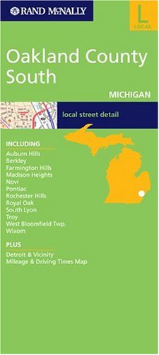
Map: Pages (2002-04)
list price: US$4.95 -- used & new: US$4.95
(price subject to change: see help)
Asin: 0528992945
Canada | United Kingdom | Germany | France | Japan
Editorial Review

Product Description
This detailed map of southern Oakland County, Michigan has complete coverage for the area, with inset maps for towns, plus most major tourist and business districts. When you flip the map over, you will find a complete street index and a "city and vicinity" map of the entire metro area. ... Read more


15. The Complete City Maps of Michigan
by Dave Denzer
 Paperback: Pages (1995-06)
list price: US$19.95 -- used & new: US$63.96
(price subject to change: see help)
Asin: 1882062027
Canada | United Kingdom | Germany | France | Japan

16. ROAD MAP OF KENT COUNTY MICHIGAN MAY 1ST 1946
by [KENT COUNTY MICHIGAN]
 Unknown Binding: Pages (1946)

Asin: B00451Y0L0
Canada | United Kingdom | Germany | France | Japan

17. Family Maps of Calhoun County, Michigan, Deluxe Edition
by Gregory A. Boyd
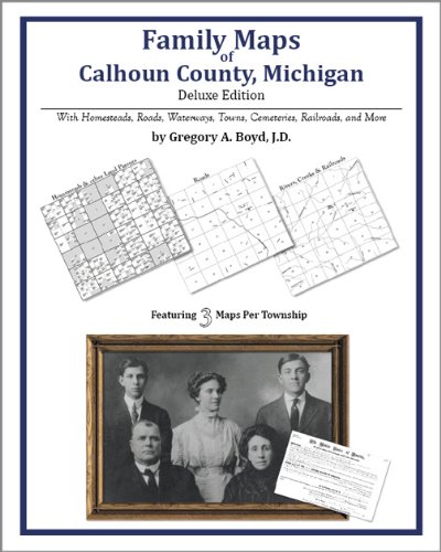
Paperback: 304 Pages (2010-07-16)
-- used & new: US$32.95
(price subject to change: see help)
Asin: 1420313487
Canada | United Kingdom | Germany | France | Japan
Editorial Review

Product Description
Locating original landowners in maps has never been an easy task--until now. This volume in the Family Maps series contains newly created maps of original landowners (patent maps) in what is now Calhoun County, Michigan, gleaned from the indexes of the U.S. Bureau of Land Management. But it offers much more than that. For each township in the county, there are two additional maps accompanying the patent map: a road map and a map showing waterways, railroads, and both modern and many historical city-centers and cemeteries.

Included are indexes to help you locate what you are looking for, whether you know a person's name, a last name, a place-name, or a cemetery. The combination of maps and indexes are designed to aid researchers of American history or genealogy to explore frontier neighborhoods, examine family migrations, locate hard-to-find cemeteries and towns, as well as locate land based on legal descriptions found in old documents or deeds.

The patent-maps are essentially plat maps but instead of depicting owners for a particular year, these maps show original landowners, no matter when the transfer from the federal government was completed. Dates of patents typically begin near the time of statehood and run into the early 1900s.

This high-quality paperback book from the critically acclaimed Family Maps series measures 8-3/8" wide x 10-5/8" high. ... Read more


18. Rand McNally Ann Arbor Brighton/Howell Michigan (Rand McNally City Maps)
by Rand McNally and Company
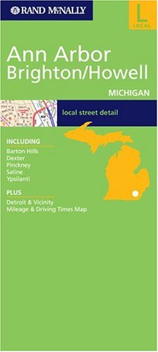
Map: 1 Pages (2002-08)
list price: US$4.95 -- used & new: US$77.43
(price subject to change: see help)
Asin: 0528993364
Canada | United Kingdom | Germany | France | Japan

19. Michigan bibliography. A partial catalogue of books, maps, manuscripts and miscellaneous materials relating to the resources, development and history of ... citation of libraries in which the materia
by Floyd Benjamin Streeter
Paperback: 760 Pages (2010-09-01)
list price: US$52.75 -- used & new: US$35.95
(price subject to change: see help)
Asin: 1178208346
Canada | United Kingdom | Germany | France | Japan

20. Michigan Northern Highlands (State Regional Road Fold Maps)
 Map: 1 Pages (2006-04)
list price: US$5.95
Isbn: 0762537744
Canada | United Kingdom | Germany | France | Japan

  1-20 of 100 | Next 20
A  B  C  D  E  F  G  H  I  J  K  L  M  N  O  P  Q  R  S  T  U  V  W  X  Y  Z  

Prices listed on this site are subject to change without notice.
Questions on ordering or shipping? click here for help.

site stats