-
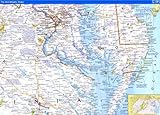
- National Geographic Close-up USA Map: Maryland, Virginia, Delaware, West Virginia (Mid-Atlantic States)
- Delaware, Maryland, Virginia, West Virginia (Highway/Road Map) by American Oil Company, 1965
- Map of Delaware, Maryland, Virginia, West Virginia, North Carolina, Kentucky, Tennessee, Ohio and Indiana. by MARYLAND, VIRGINIA, WEST VIRGINIA, NORTH CAROLINA, KENTUCKY, TENNESSEE, OHIO, INDIANA) . DELAWARE, 1873
- Map of Delaware, Maryland, Virginia and West Virginia. by (DELAWARE / MARYLAND / VIRGINIA / WEST VIRGINIA), 1900
- West Virginia Geological Survey-Map 1931.Randolph County. by West Virginia Geological Survey., 1931
- Geology of Oil & Gas Fields in Steubenville, Burgettstown and Claysville Quadrangles (Ohio, West Virginia and Pennsylvania) WITH MAPS by W.T. Griswald and M.J. Munn, 1907
- Delaware - Maryland - Virgina - West Virginia. Sunoco Road Map and Historical Scenic Guide. Map title: Sunoco Historic Pictorial Map of Delaware - Maryland - Virgina - West Virginia. by DELAWARE / MARYLAND / VIRGINIA / WEST VIRGINIA), 1940
- Papers of the Bibliographical Society of america V Forty Five 3d Q 1951Frontier Presidios of New Spain; Ruysch Map of World; Early West Virginia Imprints by Lawence C; Bradford F Swan; Boyd B Stutler Wroth, 1951
- Virginia/West Virginia (State Fold Map)
- West Virginia Geological Survey - Maps 1923 - Grant and Mineral Counties by n/a, 1923-01-01
- Raven Wall Map for the State of West Virginia - Paper by Raven Maps, 1993
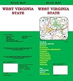
- West Virginia State Road Map by GM Johnson & Associates Ltd., 2006-11-15
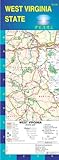
- West Virginia State Pearl Map (Laminated) by GM Johnson & Associates Ltd., 2006-09-01
|