e99 Online Shopping Mall

Geometry.Net - the online learning center Help  
Home  - Basic W - Wyoming Maps (Books)

  1-20 of 109 | Next 20
A  B  C  D  E  F  G  H  I  J  K  L  M  N  O  P  Q  R  S  T  U  V  W  X  Y  Z  

click price to see details     click image to enlarge     click link to go to the store

$22.95
1. Wyoming Atlas & Gazetteer
$5.07
2. Rand Mcnally Montana & Wyoming
$3.12
3. Wyoming Topographic Recreational
 
4. Grand Teton National Park, Wyoming,
 
5. Colorado Wyoming Map (State Maps-USA)
 
6. Wyoming : index to topographic
$2.83
7. Rand McNally Easy to Read Montana/
$9.25
8. Cloud Peak Wilderness, Wyoming
$3.95
9. Idaho Montana Wyoming: Road Map
$4.95
10. Colorado/Wyoming Folding Map
$11.25
11. National Geographic Yellowstone
$6.95
12. AAA CAA Western States / Provinces:
13. National Geographic Destination
$3.95
14. Rand McNally Laramie, Wyoming
15. Troutmap RiverGuides North Platte
 
$139.91
16. Big Horn County, Wyoming: Facts
$6.95
17. Wyoming Geologic Highway Map
$49.99
18. Raven Wall Map for the State of
19. Experimental Digital Shaded-Relief
 
20. Casper/Cheyanne, Wyoming: City

1. Wyoming Atlas & Gazetteer
by DeLorme
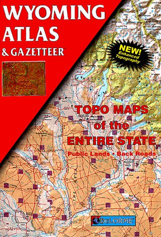
Paperback: 72 Pages (1998-08)
list price: US$16.95 -- used & new: US$22.95
(price subject to change: see help)
Asin: 0899332617
Average Customer Review: 4.5 out of 5 stars
Canada | United Kingdom | Germany | France | Japan
Editorial Review

Product Description
The first choice of outdoors enthusiasts. Beautiful, detailed, large-format maps of every state. Perfect for home and office reference, and a must for all your vehicles. Gazetteer information may include: campgrounds, attractions, historic sites & museums, recreation areas, trails, freshwater fishing site & boat launches, canoe trips or scenic drives. Categories vary by state ... Read more

Customer Reviews (9)

5-0 out of 5 stars Nice Map
Just like all the other state Delorme maps which are great.There is a section at the beginning specifically for Yellowstone which is really nice.

4-0 out of 5 stars overall very useful maps
the 'see-inside' feature for this map must be from an older edition though. one of the samples shown (pg8) was distribution of game birds, which does not appear to be in the 2009 edition.

4-0 out of 5 stars I like these atlas/gazeteers by Delmorme
I have purchased these for Wyoming, Arizona, Colorado and Utah so far.They are great to take along on a road trip as they are very detailed and show you where so much is.Elevation, rivers, places to camp etc are just a few of the things in these books.I will continue to buy other states based in the western U.S. as I plan to continue to take road trips.

5-0 out of 5 stars Best for finding back roads, trails, and the perfect campsite
This is the atlas I recommend for finding back roads and hiking trails. These guides are very detailed because they are written for each individual state. Hawaii's map pages are 1:84,000 scale and parts of Alaska can have 1:1,1,400,000 scale. Visit http://delorme.com and you can get information on map scales and elevations for the state you're interested in.

I can thank this book for the best 4th of July I ever had. We live in Washington State. Everyone knows that camping is very crowded over the 4th. It was in this book that I found Lost Lake. It's a small lake tucked into the mountains off highway 12 near Mt. Rainier. Lost Lake is off the beaten path and our atlas showed us the way to get there. Not only did we find Lost Lake but we had a waterfront campsite and I caught my limit of rainbow trout. There are many more lakes that we will explore next summer using this atlas. Visit our blog at www.radiodirectoryvagabonds.blogspot.com - and you can see Lost Lake and the beautiful campsite we found. The book is great for armchair journeys, finding boat launches, streams, and public hunting and fishing grounds. This is great for trip planning and treasuring hunting for the perfect campsite!

Ken Fritz author of The United States Radio Directory: A Traveler's Favorite Companion 2008-2009

4-0 out of 5 stars A Must Have
This atlas is a must have for going off the paved roads in Wyoming (or really any western state) for both planning and driving.

My only question is; I'm not sure how often they update these books with changes? It would be nice for them to indicate that. Some trails and/or dirt roads seem to have changed some from when these books were published. But over all the detail is good for being that it covers the entire state. There are some local area maps of state and federal lands that show better detail and seem to be more updated. ... Read more


2. Rand Mcnally Montana & Wyoming (Rand McNally Easyfinder)
Map: Pages (2004-11-12)
list price: US$7.95 -- used & new: US$5.07
(price subject to change: see help)
Asin: 0528856138
Canada | United Kingdom | Germany | France | Japan
Editorial Review

Product Description
The durable and convenient EasyFinderTMof Montana and Wyoming will take all the wear and tear your journey can dish out. The laminated design allows you to mark your route, make notes, then wipe the surface clean for further use.

This map features enhanced cartography with: Clearly indicated highways,County Boundaries, Streets,Points of Interest and National Parks. ... Read more


3. Wyoming Topographic Recreational Map
by GTR Mapping
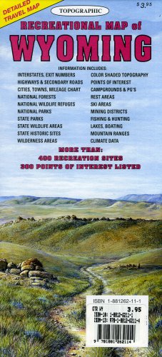
Map: 1 Pages (2006-01-01)
list price: US$3.95 -- used & new: US$3.12
(price subject to change: see help)
Asin: 1881262111
Average Customer Review: 4.5 out of 5 stars
Canada | United Kingdom | Germany | France | Japan
Editorial Review

Product Description
Topographic full color Wyoming state map is scaled at 1" = 12.5 miles. Elevation contours each 1,000 feet (color shaded each 2,000 feet at higher elevations) portray the general geography. Also shown are national forests, wilderness areas, campgrounds, parks, state game and fish areas, ski areas, mining districts, points of interest, and more. More roads are shown than on typical highway maps.? Much printed information is also included. ... Read more

Customer Reviews (3)

5-0 out of 5 stars Wyoming: More Like Funoming
First let me begin with a little honesty: for 25 years I wasn't even sure if Wyoming was real.I kept seeing it on maps and Geography tests, but I figured maybe it was some sort of inside joke between teachers and cartographers.I had never met anyone from Wyoming, nor ever heard any bit of news from there, so I figured it must not exist.So I bought this map and went on a road trip to dispel the myth.And let me tell you: Wyoming should be renamed Funoming.

The map is awesome.It not only has all four dirt roads in Wyoming perfectly mapped, but it also has a great informational guide that shows you the many places you may visit and fun facts about Wyoming.These Wonders of Wyoming include, "Best place to take a dump" (behind any of the trees), the "number of people who live in Wyoming" (0), and "Wyoming's biggest export" (air).

During my road trip I visited many great places, such as "Tree #1" through "Tree #892,340,421,324," "Big Gray Rock," and "Litter that blew in from Utah."I never did meet anyone, but that might be because the place reminds me of Deliverance.

I would absolutely, unequivocally recommend this map for anyone who wants to visit Wyoming because they really love trees, really hate people, or wanted to experience the only kind of boredom that Funoming can offer.

4-0 out of 5 stars Much better than free WY state map.
On our WY road trip this map was more helpful than the free WY state map we had used on a previous trip. Other tourists we assisted in route finding by showing them this map wanted to know where we bought ours and were very disappointed that it came from Amazon and that we couldn't just refer them to a nearby store. In WY we didn't come across this map so were glad we ordered it in advance.

5-0 out of 5 stars great maps
These are great reference maps for generalized recreational activities.Not as detailed as a topo map, but still packed full of outstanding informatin.I have one for every state and I don't leave home with out them. ... Read more


4. Grand Teton National Park, Wyoming, 1:62,500-scale topographic map(SuDoc I 29.2:G 76/13)
by National Park Service
 Map: Pages (1991)

Asin: B000106W5G
Canada | United Kingdom | Germany | France | Japan

5. Colorado Wyoming Map (State Maps-USA)
by Rand McNally
 Paperback: 1 Pages (1996-06)
list price: US$2.95
Isbn: 0528967673
Canada | United Kingdom | Germany | France | Japan

6. Wyoming : index to topographic and other map coverage (SuDoc I 19.41/6-3:41104-MI-99 X/995)
by U.S. Geological Survey
 Unknown Binding: Pages (1995)

Asin: B00010SR72
Canada | United Kingdom | Germany | France | Japan

7. Rand McNally Easy to Read Montana/ Wyoming State Map (Rand Mcnally Easy to Read!)
by Rand McNally and Company
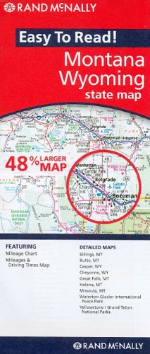
Map: Pages (2010-03)
list price: US$5.99 -- used & new: US$2.83
(price subject to change: see help)
Asin: 0528881817
Canada | United Kingdom | Germany | France | Japan

8. Cloud Peak Wilderness, Wyoming - Trails Illustrated Map # 720
by National Geographic Maps
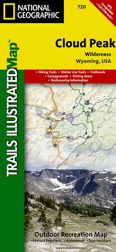
Map: 2 Pages (2007-07-01)
list price: US$11.95 -- used & new: US$9.25
(price subject to change: see help)
Asin: 1566954177
Average Customer Review: 5.0 out of 5 stars
Canada | United Kingdom | Germany | France | Japan
Editorial Review

Product Description
Coverage includes Bighorn National Forest, Highland Park, Meadowlark Lake, Kearny Lake Reservoir, Coffeen Park. Includes UTM grids for use with your GPS unit.

Scale = 1:45,000 Size: 25'' x 38'' ... Read more

Customer Reviews (1)

5-0 out of 5 stars Awesome map
Awesome map, more detailed than I would have thought. A must for anyone planning a journey to the Beautiful Bighorn Mountains. ... Read more


9. Idaho Montana Wyoming: Road Map (Travelvision State Maps)
by American Map Corporation
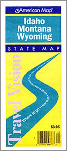
Map: Pages (1997-06)
list price: US$3.95 -- used & new: US$3.95
(price subject to change: see help)
Asin: 0841650616
Canada | United Kingdom | Germany | France | Japan
Editorial Review

Product Description
This Idaho / Montana / Wyoming map features points of interest, airports, camping facilities, parks, selected local attractions and more. State maps feature insets of major cities. Our city map offers additional detail, with depiction of streets on one side and a large scale metro area road map on the other. ... Read more


10. Colorado/Wyoming Folding Map
by Universal Map
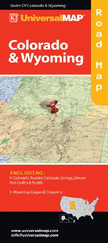
Paperback: Pages (2010-01-26)
list price: US$4.95 -- used & new: US$4.95
(price subject to change: see help)
Asin: 0762566914
Canada | United Kingdom | Germany | France | Japan

11. National Geographic Yellowstone National Park Wyoming/Montana, USA: Trails Illustrated Topo Map (Trails Illustrated - Topo Maps USA)
by Trails Illustrated, National Geographic Maps
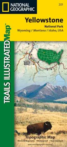
Map: 1 Pages (1983-06)
list price: US$9.95 -- used & new: US$11.25
(price subject to change: see help)
Asin: 0925873012
Average Customer Review: 4.0 out of 5 stars
Canada | United Kingdom | Germany | France | Japan
Editorial Review

Product Description
National Geographic Rockies: National Geographic Maps 603100 By National Geographic ... Read more

Customer Reviews (5)

5-0 out of 5 stars National Geographic Maps are the best
Great readable maps with just the right amount of detail.Used with my Garmin Colorado they can't be beat.

4-0 out of 5 stars It's a good map
It's a good topo map but I found it impractical due to its size to take on hikes.Try looking at a 3 x 3 map on top of a mountain in a 15 to 20 mile per hour wind.When you are on a hike you don't need a map of the whole park - you only need a map of the area you are actually hiking in.For this I used a hiking book which contained "zoomed in" views of the area I was hiking in.The map worked great, however, back in the hotel room when planning the next day's hike.

4-0 out of 5 stars If you're new to Rocky Moutain NP
Recommended for hikers new to RMNP.Stick this in your backpack for quick reference while on the trail.Water resistant and tear resistant paper.

2-0 out of 5 stars Nice map, but waaayyy too high level
This map looks nice, but if you're going hiking, you'll be better off with the free park maps given at the park. It's just way too high level, with 100-foot contours, and very little detail. It's also not waterproof or resistant.

5-0 out of 5 stars Essential map for hiking and backpacking
This is the essential topographical map for hiking in Yellowstone.Trails Illustrated also sells some maps of particular regions of the park such as Tower/Canyon at 1:83,333 scale.(The map of the whole park is 1:168,500.)The bigger map is perfectly serviceable for any hike that you might want to take, and I can't find any place in the park where the big map would lead you astray.Still, if you like having the smaller scale, go for it.

The small maps do have the advantage of showing specific backcountry campsites.If you use the larger map, you have to coordinate with other books that show these sites.

Like other Trails Illustrated maps, this one comes with all sorts of practical information on the back side of the map.None of this will be new to you if you've read the usual guide books, but it's moderately useful having it repeated here.One very helpful feature of this map is that it shows the burn areas so that you can avoid moderately or heavily burnt forests.

The trail numbers on this map are coordinated with Day Hiking Yellowstone by Tom Carter.I don't have that book so I can't vouch for how useful it is.However, it's easy to coordinate the numbered trails with other books that I do have (such as Lonely Planet Yellowstone and Grand Teton National Parks, Hiking Yellowstone National Park: A Falcon Guide, and A Ranger's Guide to Yellowstone Day Hikes).
-----
Added in April 2008: the more I hike in the park, the less happy I am with this map because of the scale.It's great for seeing longer trails at a glance.But if you're a day-hiker, you probably want one of the four smaller-scale maps covering (more or less) the four corners of the park. ... Read more


12. AAA CAA Western States / Provinces: Including Alberta, Arizona, British Columbia, California, Colorado, Idaho, Montana, Nevada, New Mexico, Oregon, Saskatchewan, Utah, Washington, Wyoming: Plus Mexico Insurance Information, Driving Distance Charts (North American Regional Series 2007, 2007-521907)
by AAA, CAA
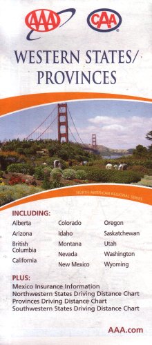
Map: 1 Pages (2007)
-- used & new: US$6.95
(price subject to change: see help)
Asin: 1075219078
Canada | United Kingdom | Germany | France | Japan

13. National Geographic Destination Map: Yellowstone National Park (Destination Maps for American National Parks)
by National Geographic Society, Trails Illustrated
Map: Pages (1999-01)
list price: US$11.95
Isbn: 1566950570
Canada | United Kingdom | Germany | France | Japan

14. Rand McNally Laramie, Wyoming Champion Map (Champion Maps)
Map: Pages (2007-09-07)
list price: US$3.95 -- used & new: US$3.95
(price subject to change: see help)
Asin: 0528869930
Canada | United Kingdom | Germany | France | Japan

15. Troutmap RiverGuides North Platte Wyoming Combo Map - Miracle Mile and Gray Reef


Asin: B002W81Z1Q
Canada | United Kingdom | Germany | France | Japan
Editorial Review

Product Description
North Platte, Wyoming RiverGuides for the North Platte River cover two areas: the Miracle Mile between Kordes Dam and Pathfinder Reservoir, and Gray Reef between Gray Reef Dam and Government Bridge. Where important to land-owners, private land and water is shown. Features: Sized right - These maps are easily used while floating without the unfolding and refolding of conventional maps. Loss prevention - The individual maps are secured with a molded plastic hook, that allows clipping to a zinger on waders or boat. Accurate topographic data - from US Geological Survey, showing river features and land contours in color at 1:24,000 scale (1/2"=1000 feet, same as US Geological Survey 7.5 minute series maps). Accurate river features - Rivers are checked by Troutmap staff to ensure accuracy and location of river features before maps are published. Where important to land-owners, private land and water is shown. Pin-point locations - a unique 100 meter grid permits determining a location within about 20 feet, without the use of a separate template. Map size - 3-7/16 inches by 10-1/8 inches; laminated size: 3-11/16 inches by 11 inches. ... Read more


16. Big Horn County, Wyoming: Facts and maps through time
by Bruce H Blevins
 Unknown Binding: 81 Pages (2000)
-- used & new: US$139.91
(price subject to change: see help)
Asin: 1893771040
Canada | United Kingdom | Germany | France | Japan

17. Wyoming Geologic Highway Map
Map: Pages (2000-01-01)
list price: US$6.95 -- used & new: US$6.95
(price subject to change: see help)
Asin: 1881262014
Canada | United Kingdom | Germany | France | Japan
Editorial Review

Product Description
Geological formations are depicted in full color, along with cities, towns, interstates, highways, and some local roads. Also a Geologic Explanation, Rock Column, Block Diagram, and Cross Section on the front. On the back is a full color shaded elevation map of Wyoming, with selected mining districts and dinosaur localities, along with text information. ... Read more


18. Raven Wall Map for the State of Wyoming - Laminated
by Raven Maps
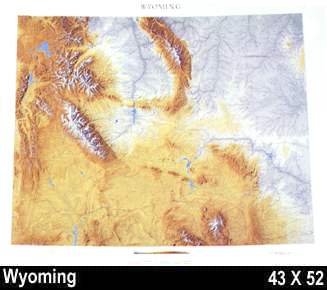
Unknown Binding: Pages (2003)
-- used & new: US$49.99
(price subject to change: see help)
Asin: B003N3Q924
Canada | United Kingdom | Germany | France | Japan
Editorial Review

Product Description
Raven Wall Map For The State Of Wyoming (Laminated). All Raven state wall maps display an incredible amount of detail, from cities, highways, and mountain ranges, to valleys, rivers, and small towns. The Wyoming map elevations are represented by color, and this, in combination with Raven's relief shading technique, gives the map a lush, 3-dimensional look.Size = 43 x 52 Inches ... Read more


19. Experimental Digital Shaded-Relief Maps of Wyoming (Miscellaneous Investigations Series, Map I-1846)
by Kathleen Edwards, R. M. Batson
Map: Pages (1990)

Asin: B0038O9IQC
Canada | United Kingdom | Germany | France | Japan
Editorial Review

Product Description
Experimental Digital Shaded-Relief Maps of Wyoming. Two maps -- one grayscale, the other colored. Scale of maps = 1:1,000,000. ... Read more


20. Casper/Cheyanne, Wyoming: City Map (Rand McNally)
by Rand McNally
 Map: Pages (1999-12)
list price: US$2.95
Isbn: 0914449818
Canada | United Kingdom | Germany | France | Japan

  1-20 of 109 | Next 20
A  B  C  D  E  F  G  H  I  J  K  L  M  N  O  P  Q  R  S  T  U  V  W  X  Y  Z  

Prices listed on this site are subject to change without notice.
Questions on ordering or shipping? click here for help.

site stats